The MS-96, a major technological asset for Industry 4.0
MS-96, a major technological asset for Industry 4.0 From the rise of mechanization to the digital revolution, the industry has gone through different periods over the centuries, all marked by major technological advances. From Industry 1.0 in the 18th century, characterized by the mechanization of production processes, to the current era of Industry 4.0, where […]
Reinventing gas stations with the MS-96 mobile laser scanner
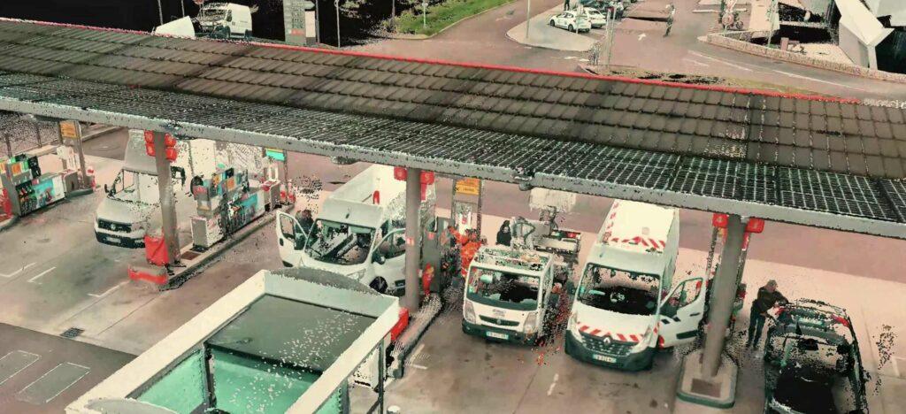
Reinventing gas stations with the MS-96 mobile laser scanner Summer sees a dramatic increase in road traffic each year as millions of vacationers hit the road for sunny destinations. In Europe, for example, the A7 motorway in France, nicknamed the “Autoroute du Soleil”, sees its traffic increase by 30 to 40% during the months of […]
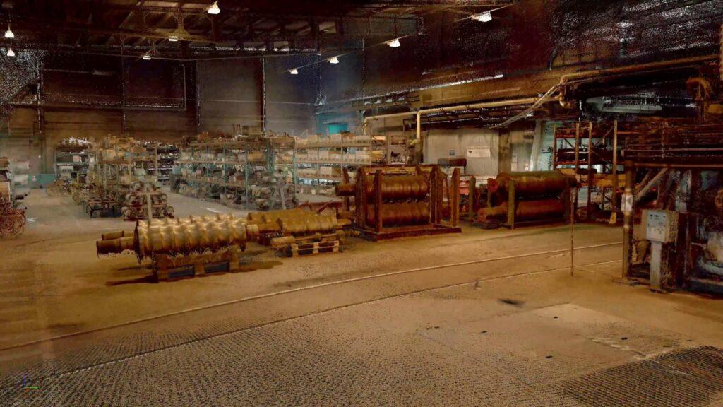
With the MS-96, all scans are not grey in the dark
With the MS-96, all scans are not grey in the dark Among its unique features, the MS-96 includes a 20,000 lumen lighting system that optimizes scans in dark environments. This unique functionality once again illustrates the perfect modularity of the Viametris mobile laser scanner, allowing you to continue to see the world in all its […]
Place your bets ! The MS-96 enters the arena.
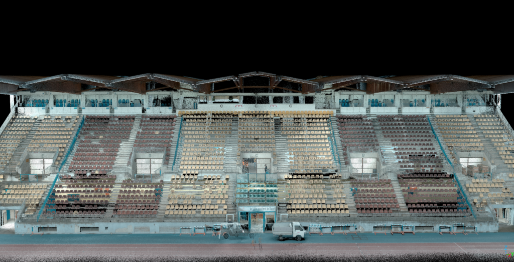
Place your bets ! The MS-96 enters the arena. Between the Euro football championship in Germany, the organization of XXL concerts and the hosting of the Paris 2024 Olympic Games, sports venues will be the stars of this summer. Formerly dedicated exclusively to sporting competitions, stadiums and sports halls have undergone a remarkable transformation over […]
11 pitfalls to avoid to ensure good data quality

11 mistakes to avoid to obtain good data quality Gasoline in the car. Checked. Battery charged. Checked. Weather forecast. Checked. The day before, everything was carefully reviewed, the scan on site went well. Back at the office, the data is transferred to the computer. And here is the drama! The point cloud is distorted, images […]
MS-96 and bridge surveillance, the perfect combo
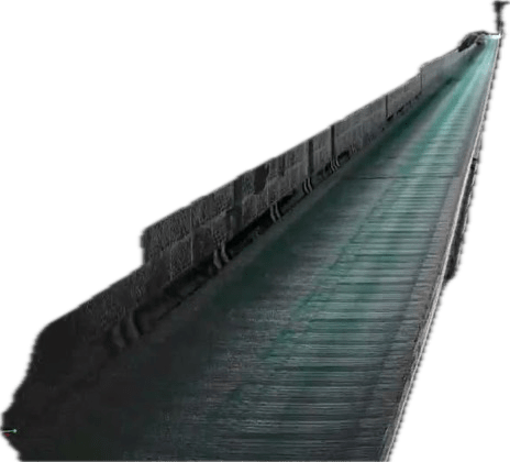
MS-96 and bridge surveillance, the perfect combo Road, rail, pedestrian or special, there are hundreds of thousands across the world connecting countries, cities and continents. For tourists (Tower Bridge in London), historical (Pont-Neuf in Paris), architectural splendors (Helix Bridge in Singapore), or icons of a city (Golden Gate in San Francisco), these marvels of civil […]
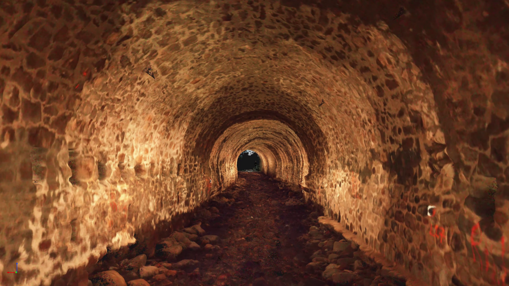
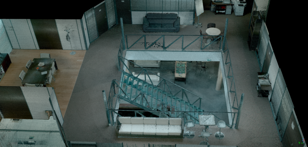
Scan me if you can!

Scan me if you can! “Blade Scanner” tells the story of Detective John Doe, who is in pursuit of a notorious criminal hiding in the sprawling tunnels of a large futuristic city. John and his team must navigate this complex and dangerous maze, while mapping their progress with their MS-96 to avoid getting lost. This […]
Data confidentiality

Cloud vs local data processing, which method should you prefer? Cyberattacks against companies and institutions, targeting sensitive data such as medical, banking or commercial information, are constantly increasing. Can the mobile mapping industry be affected? The crucial question of the confidentiality of processed scan data is becoming more than relevant, especially when it comes from […]
10 things to know before purchasing a dynamic laser scanner
10 things to know before purchasing a mobile laser scanner The acquisition of a mobile laser scanner is a consideration that arises today among many professionals working in the fields of architecture, BIM, cartography, construction or 3D modeling. From the announced precision to the different levels of expertise and the choices between mono-LiDAR and multi-LiDAR […]
Improving transport accessibility with mobile scanning technology
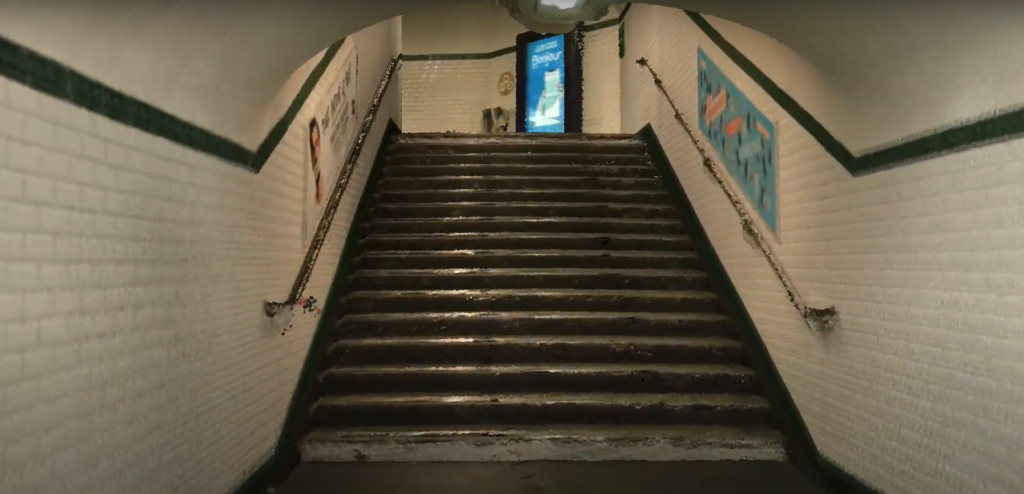
Improving transport accessibility with mobile scanning technology The organization of the upcoming Olympic and Paralympic Games in Paris has raised difficulties in accessing Parisian transport for people with reduced mobility. In the French capital, only 13 metro stations, except those on line 14, are accessible to people with reduced mobility. And at the global level, […]