In an era where environmental threats are increasing, technology can become an essential ally in anticipating the risks linked to climate change. The polders in the Netherlands, land reclaimed from the sea, are particularly vulnerable to global warming despite their dikes and sophisticated drainage systems. A regular 3D scan of the banks will make it possible to identify areas at risk and define the protection measures to be implemented.
A 3D scan, powered by the Global Positioning Satellite System (GNSS), provides a detailed centimeter-by-centimeter view of the terrain. As long as you are equipped with it! The MS-96, equipped with a multi-constellation GNSS antenna and a high-end receiver, makes it possible to obtain this type of precision natively via a so-called differential GNSS calculation relying on fixed base stations. This extreme precision can be crucial. Rising sea levels put additional pressure on sea walls and protection systems. This growing threat increases the risk of flooding, putting fertile land and vital infrastructure at risk.
By identifying areas at risk of deformation from rising waters, authorities can plan proactive renovations. This anticipation allows them to move from reaction to prevention, thus saving lives and preserving invaluable resources.
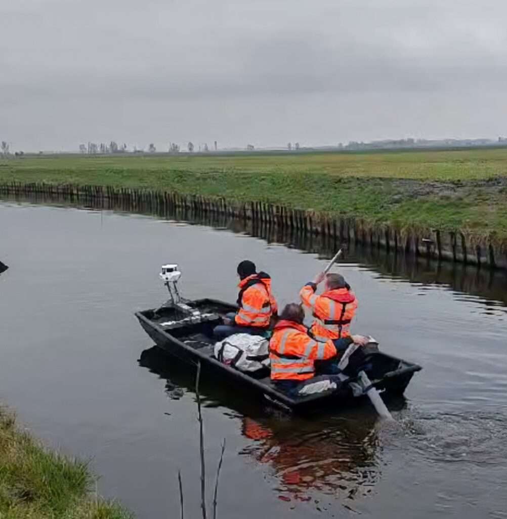
Boarding a boat, passing through tunnels, scanning canals remains a real technological and logistical challenge. In the following example, the MS-96’s mission was to scan a canal located near the Schiphol airport. A strategic area because the slightest change in the surrounding topography could potentially compromise the safety of roads, taxiways and even the flights themselves. This is where 3D scanning comes into play, offering unparalleled precision during mapping to detect the slightest variations in terrain. Regular monitoring by local authorities may prove essential in the future. Apart from saving time compared to a pictures-based survey, a scan will provide them with more accuracy. By comparing the data after each new passage, they will be able to note any variations in the terrain or possible damage to the banks, and thus decide on the implementation of appropriate protection actions.
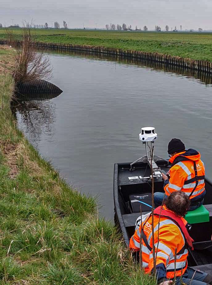
The exercise may seem trivial. But it is not, far from it! To put a mobile 3D scanner on a boat, several criteria must be met. And the MS-96 has them all:
[ Embark for a tour and overview of the site with this point cloud. ]